NEW - A summary of public input from the November 16th open house is now available. Thank you to those who completed a comment form; we received a total of 233. To view the summary, click here.
To view the informational display boards presented at the Tuesday, November 16th open house use the open house stations menu to the right.
The purpose of the study's second public open house was to:
- Present alternatives for accommodating increasing rail traffic;
- Share the factors being considered in the alternative selection process;
- Show the preliminary evaluation results for each alternative based on these factors; and
- Obtain public input on which alternative will best serve the City of Springfield.
Open House Station List:
Station #1: Project Information & Alternative Selection Criteria
Station #1: Project Information & Alternative Selection Criteria
Station #2: Double Track 3rd Street
Station #3: Historic Structures
Station #4: Shift 3rd Street to 10th Street
Station #5: Noise & Vibration
Station #6: Corridor Redevelopment
Station #7: Shift 3rd Street and 19th Street to 10th Street
Station #8: Land Acquisition
Station #9: High Speed Rail
Station #10: Non-viable Alternatives
Station #11: Public Engagement
Additional information:

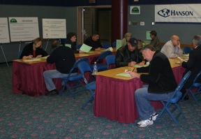
The second public open house - November 16, 2010 - was
attended by more than 300 people.
attended by more than 300 people.
First Public Informational Meeting
Tuesday, April 20, 2010
4:00 pm – 7:00 pm
Prairie Capital Convention Center
Tuesday, April 20, 2010
4:00 pm – 7:00 pm
Prairie Capital Convention Center
Display boards from the first open house are available to view and download.
Welcome Handout
-
Station 1: Project Information
Provides an overview of the project’s purpose, study -
team, participants, history, focus areas and boundaries.
- Station 2: Environmental Analysis
- Explains that the study is planned as an Environmental
- Impact Statement (EIS) and describes the process,
components, probable issues and deliverables of an EIS. - - Neighborhood Groups Map
- - Schools, Hospitals, and Parks Map
- - Bus Routes/Bike Trails Map
- - Flood Zones Map
- Station 3: Rail Safety
- Examines safety hazards associated with railroad crossings and reviews
resulting accidents, injuries and fatalities. - Station 4: Traffic Studies
- Reviews the expected increases in passenger and freight train traffic and
explores the likely delays for vehicle traffic - Station 5: Noise and Vibration
- Describes the noise and vibration impacts associated with rail traffic and
examines different methods of noise control - Station 6: Corridor Redevelopment
- Presents corridor redevelopment concepts and possible neighborhood
and community improvements - Station 7: Historic Structures
- Provides information on the types of historic buildings, structures and
archaeological resources that will be inventoried by the study team - - Survey Process
- - Section 106 & National Register
- - Property Types
- Station 8: Public Engagement
- Explores the study’s public participation opportunities and solicits
community input on project activities -
Click here to download a synposis of the public input from Station 8 at the April 20 open house. Results from the comment forms are also available.


